
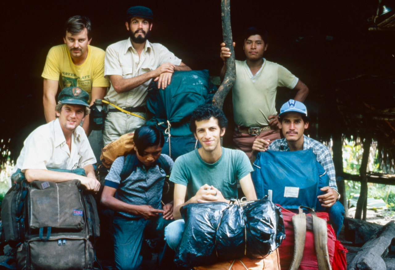
In 1982, the Costa Rican government created the La Amistad Biosphere Reserve which covers a massive area in southern Costa Rica along the Talamanca mountain range. At the time, the biosphere was relatively unknown to scientists – very few had ventured into the depths of the Talamanca. The Costa Rican National Park Service hired wildlands consultant, Jim Barborak, to assist his national counterparts in conducting a biological, anthropological and geological inventory of the biosphere.
There weren’t any photographs from the depths of the park, so I joined the research teams as a photographer for three nine-day expeditions into the La Amistad. Those three expeditions were probably the most physically challenging treks I’ve ever taken but by far the most rewarding wilderness experiences I have ever had.
Trek 1: Crossing of the Talamanca
24 Feb to 6 March 1982
On 24 February 1982 – three weeks after the Costa Rican government issued a decree to establish La Amistad, the country’s largest national park – I joined a team of scientists and park rangers in an attempt to transverse the park from the Pacific lowlands to the Atlantic lowlands.
We started on the deforested and hot western slopes of the Talamanca mountain range and ended up nine days later in Indian villages of the lowland jungles near the Caribbean coast. It was nine days hacking our way through a green hell but we made it.
In order to reach the pristine virgin rainforests of Amistad, we had to trek across some of Costa Rica’s most denuded hillsides. Our packs were loaded with supplies for the nine-day trek and the sun shone down on us mercilessly as we hiked through savannahs. One of the team members started vomiting from the heat exhaustion. If we had any sense, we would have turned back then but the challenges we faced on the first day of climbing were well rewarded when we approached the continental divide and the cool and moist cloud forests.
If you looked at a topographic map of the Talamanca Ranges you might see a dotted line which indicated a trail across the continental divide. This was the trail we were to follow but it really existed only in the cartographer’s wildest dreams.
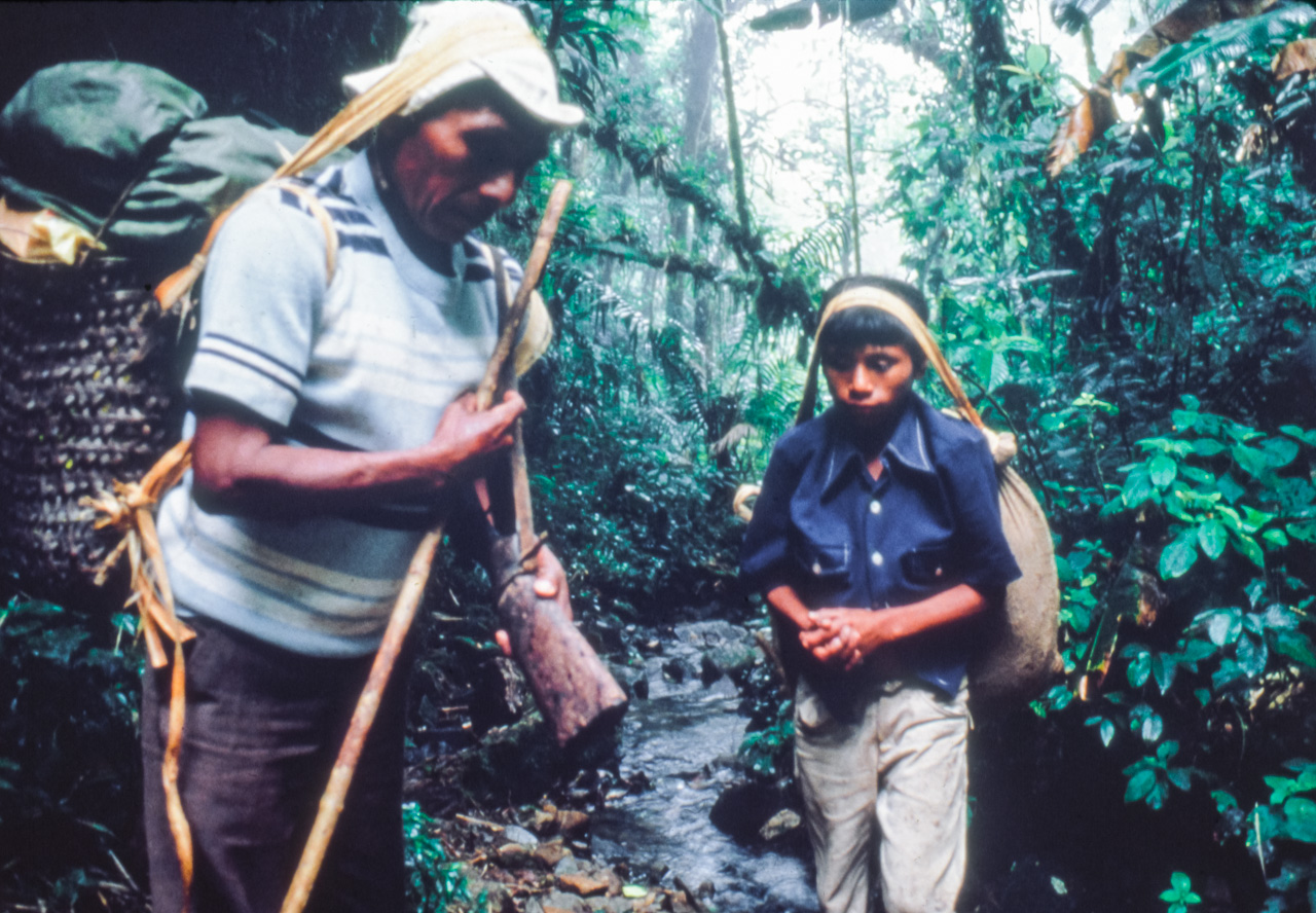
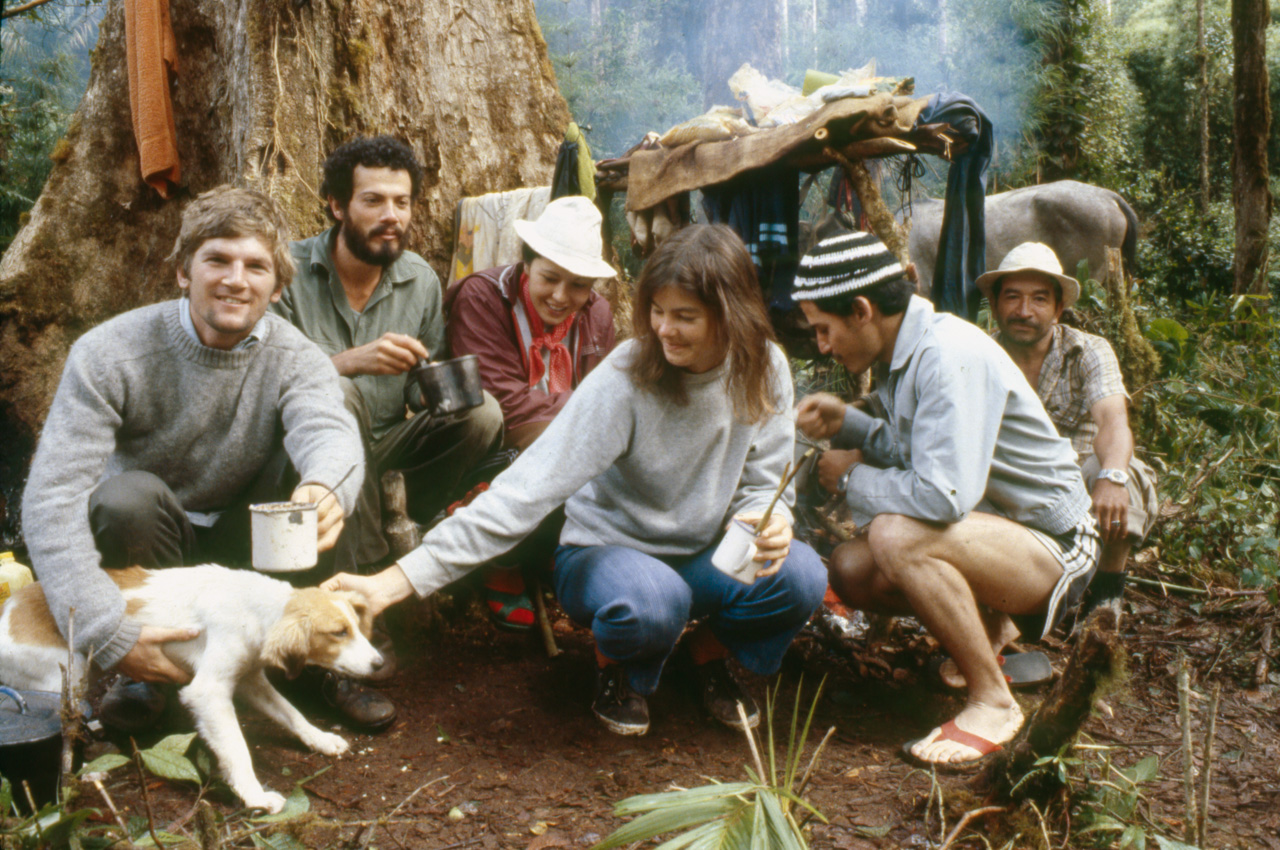
We enlisted a local Indian guide, 51-year-old Don Alberto and his 15-year-old son Bienvenido, who was making his first trek across the Talamanca.
For nine days we really only saw his back side as he moved through the jungle effortlessly and swiftly. He always had his rifle ready to add some protein to our meagre rations. At one point a troop of white faced monkey paraded across our path. Don Alberto raised his gun to take aim. I was weak from hunger and immediately started salivating at the thought of barbequed monkey for dinner. Sadly Don Alberto missed and we had our standard rations of rice and lentils.
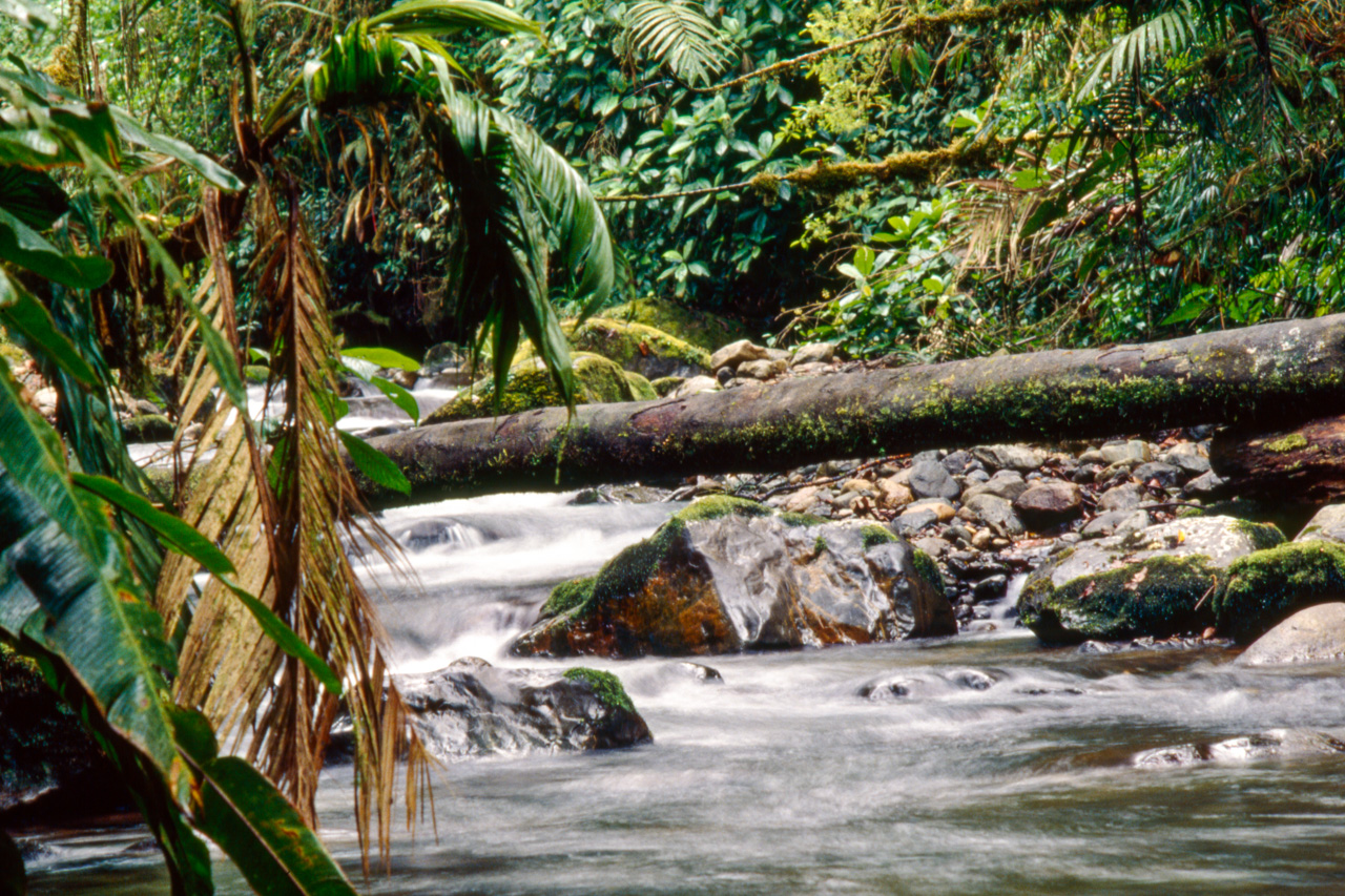
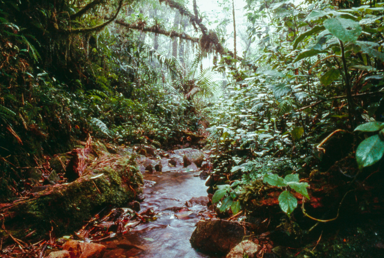
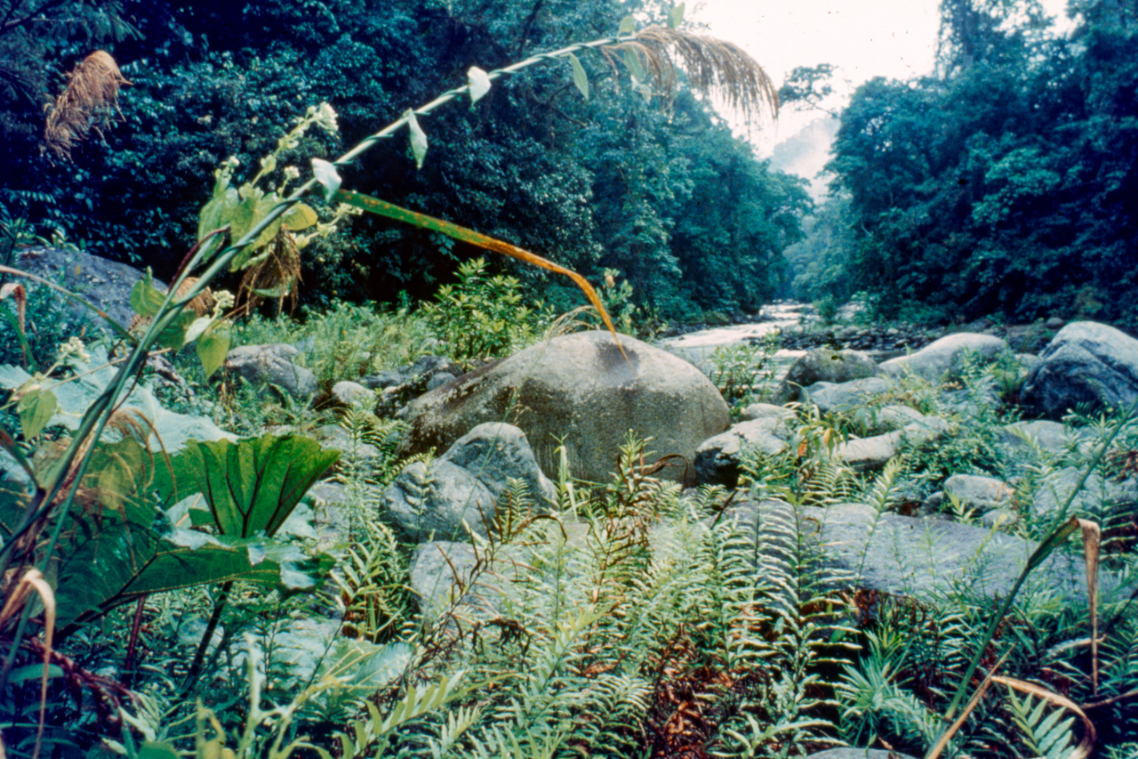
Without doubt my most favourite ecosystem in Costa Rica was the cloud forest. Cloud forests are still and quiet and you can hear the drip, drip, drip of the clouds. The only noise you’d hear is the occasional call of a bird. At about the time I took this photo I saw my first glimpse at Central America’s most majestic bird – the Resplendent Quetzal. The trail for much of the journey was as it appears in this photo.
We followed streams at times and other times hacked through jungle. I spent more time on my bum than on my feet as I was constantly slipping and sliding down the ‘trail’. We crossed the continental divide at around 2100 metres in altitude so we spent a fair time in damp cloud forest. After a few days we all felt claustrophobic as we were entombed by the dense green vegetation. Any kind of a view of more than a few metres was rare. Only when a huge tree would fall in the jungle or along good sized rivers would we get a glimpse of sunshine or a view out.
The inner depths of La Amistad International Park are a botanist’s heaven. The diversity of flora in the park is overwhelming as the floras of North and South America converge within the reserve. Few scientific teams had ventured into the region prior to 1982.
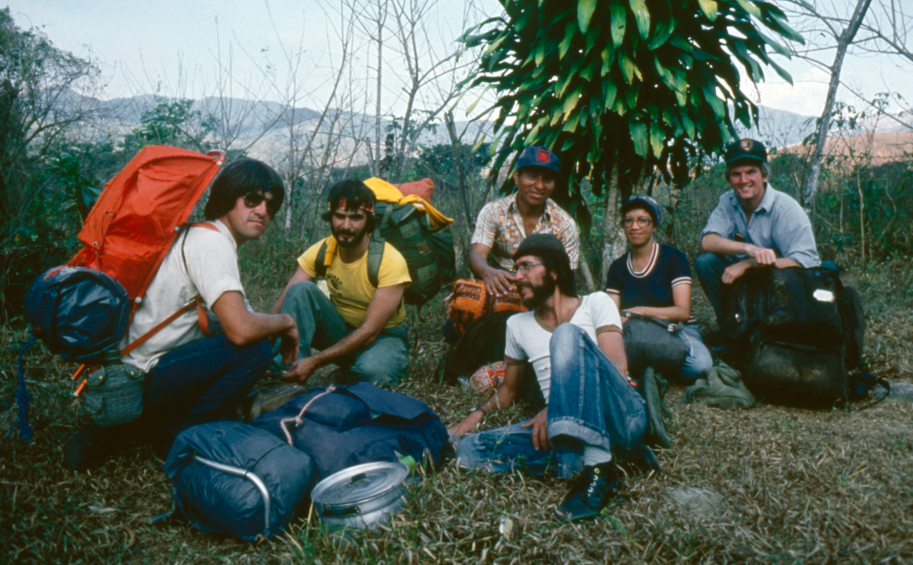
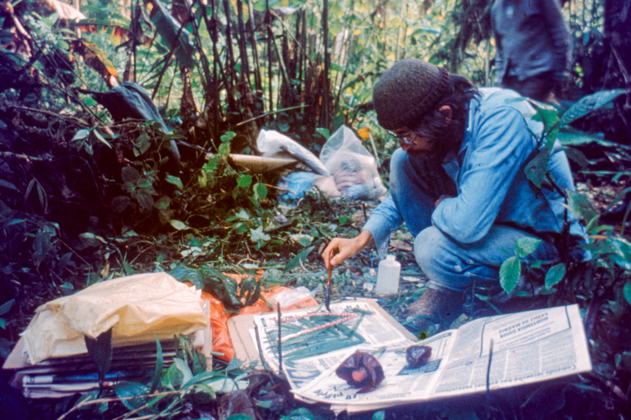
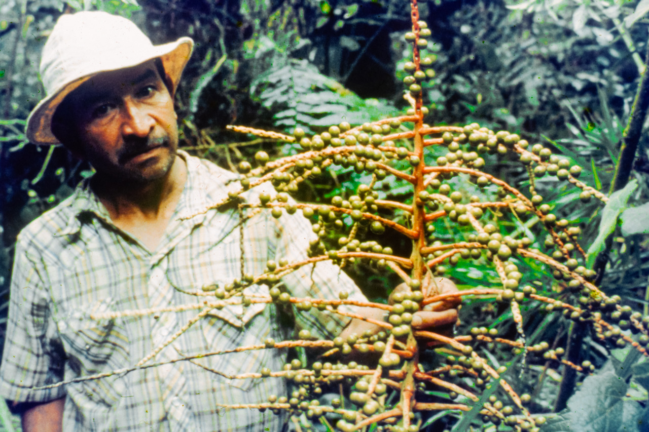
Our team leader, Rafael Ocampo, was – and still remains – a botanist with the Costa Rican National Museum with a special interest in the medicinal properties of plants. During the trek, most of our backpacks became lighter as we consumed our food supplies. Not so with Raffa who must have carted out half the jungle in his plant presses. Many botanists have since visited the Talamanca Ranges after Raffa and have now recorded 180 endemic plant species.
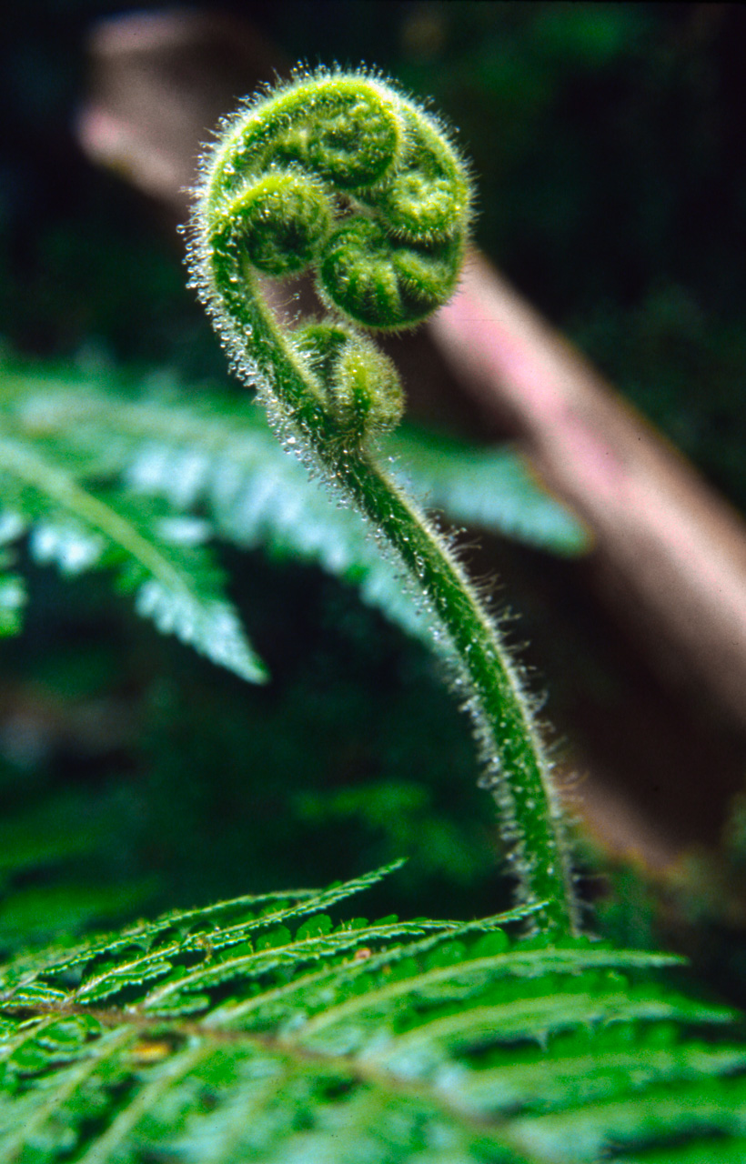
If you sit still long enough in the lush and verdant virgin forests of La Amistad, you can almost watch the plants grow. The higher elevations abound in ferns. Fiddleheads like this one fight for a bit of light filtering through the forest canopy.
On our fifth day out, we set up camp in a downpour at a spot without potable water. We couldn’t locate ourselves on any map – we had no idea where we were.
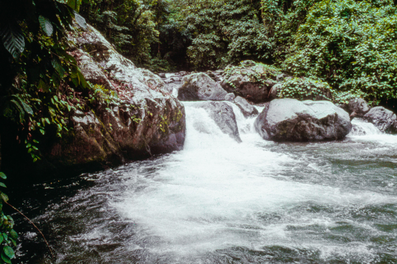
We ate a cold dinner of some bread and tuna. We had finished the rum the night before and our spirits were low so we all hid inside our tents. The rain stopped before dawn and a troop of howler monkeys woke us up. We packed up and slogged up and down a few valleys until finally around noon we encountered a beautiful pool on the Rio Tapari. It was amazing how a swim in the cool waters of the river and how a chance to sit under a ray of sunlight can instantly life your spirits.
Our final two days of the trek were along the Rio Coen and into an indigenous reserve. We gave up our tents to sleep in some Indian huts but that was a mistake as the hut was crawling with chicken lice. Slowly the tracts of virgin rain forest were replaced by cultivated tracts of banana and cacao. On the ninth day we stumbled into an Indian village of Amubri just as a small four seater plane arrived. The pilot didn’t have a load going back to Limon, so after a few celebratory beers, we commandeered the plane and returned to civilisation. We were all quite worse for wear. I was covered in insect bites and my hands were chewed up from grabbing spiny and thorny plants while constantly falling down on slippery rocks. I was sh**ting my guts out from eating or drinking something at one of the Indian huts. Others had inflamed ankles and knees. But as we flew out and glimpsed back at the massive Talamanca mountain range we had crossed, we knew we accomplished something that few, if any, had done before us and we knew that as soon as we recovered we’d be ready for another adventure in La Amistad.
Trek 2: Valle de Silencio
29 April to 3 May 1982
As I crawled into the indigenous village of Amubri after the gruelling transverse of the Talamanca mountain range on my first trek in the Talamanca, I vowed that I would never return and subject myself to the physical challenges which the first trek presented.
But after a few beers and before I reached home in San Jose I was ready for the next adventure and couldn’t wait to get back to La Amistad.
Our second excursion into La Amistad took place at the end of April in 1982. Our destination was the highlands on the border of Costa Rica and Panama.
During my adventurous youth I was very good about keeping a journal about my travels. When I combine my journal with the photos I take I find that I can vividly recall adventures of 30+ years ago. Unfortunately for my second trek to La Amistad I have neither a journal nor many photos. Only a very foggy recollection of the trip. Only three of the hundreds of photos I took on the trek have survived … with me at least, the originals reside in some cabinets somewhere in Costa Rica.
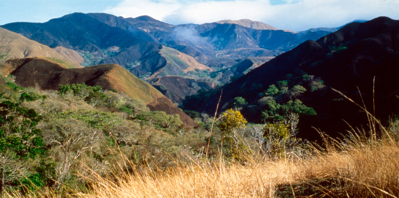
I can only recall that it was an extraordinary adventure in an almost surreal high elevation landscape. I believe we started from San Vito or Altamira near the Panamanian border and hiked to Las Alturas and Valle del Silencio and further into the park. At times we crossed into Panama but had no idea as these were the days before GPS units and the topographic maps weren’t precise.
We relied solely on our guide Solomon to get us from A to B. Thirty years later the maps still appear void of features. If you look at Google Earth at the Talamanca Range along the Panamanian border all you see is green – no roads, no villages, no landmarks, nothing.
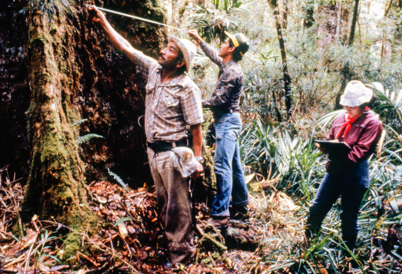
This part of La Amistad International Park was the home of an ecosystem I had never seen in Costa Rica before – the highland oak forest, which is found above 2000 metres in elevation. We trekked through pure oak stands of trees up to 40 metres which had never been touched by human hands before.
The scientists on our team did some sampling of the forest to get a basic idea of the biodiversity of the park. Wifrán and Lucía are sizing up a huge tree – I don’t think this one is an oak – with some help from our guide Salomón.
Who knows how many plants species exist within La Amistad International Park. So far scientists have identified 180 endemic species – plants found nowhere else in the world. The whole area contains a diversity of plant genera, families or species perhaps unequalled in any other reserve of equivalent size in the world, due to the convergence of the floras of North and South America and varied climatic and soil factors.
Trek 3: Caribbean slopes
13-22 May 1982
Ten days after I returned from the Valle del Silencio trek and 10 days after I vowed never to return to the Talamanca, I packed my gear for another trek again into the unknown.
I joined a team led by wildlands planner and head of the La Amistad management team, Jim Barborak, and explored the indigenous reserves on the Caribbean slopes of the mountain range.
We departed from the Tropical Agricultural Research and Training Centre (CATIE) in Turrialba and drove south till the road ended. We spent about 10 days on this trek but like the Valle del Silencio trek I have neither notes nor photos. One day I’m hoping someone in Costa Rica will be able to retrieve my Amistad photos so I can properly scan them and preserve them. Until then I only have three photos from this trek and my only memories are of rain, rain, and more rain and slogging through mud, mud and more mud.
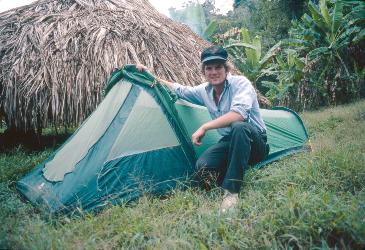
I felt sorry for my Tico counterparts on these treks to La Amistad. The concept of trekking and backpacking was foreign to Costa Ricans and specialised equipment just wasn’t available in the country. The scientists and park guards who formed these teams had the crappiest of all equipment. When it rained their tents leaked, when the wind blew their tents fell down. When their sleeping bags got wet they stayed wet. And when they hiked, they fell down as their backpacks failed to hug their bodies.
On the other hand, I was fresh from the US and had all the latest in backpacking gear. I loved my tent which was ideally suited for the tropics. In the dry season I could open it up and have a clear view of the stars and stay cool and yet stay dry in the rainy season. I remember on this particular trek that one night it poured endlessly and it poured hard. It seemed like we would all float away and I remember lying in my sleeping bag waiting for my little tent to collapse. But it never did and unlike my Tico counterparts I got some sleep.
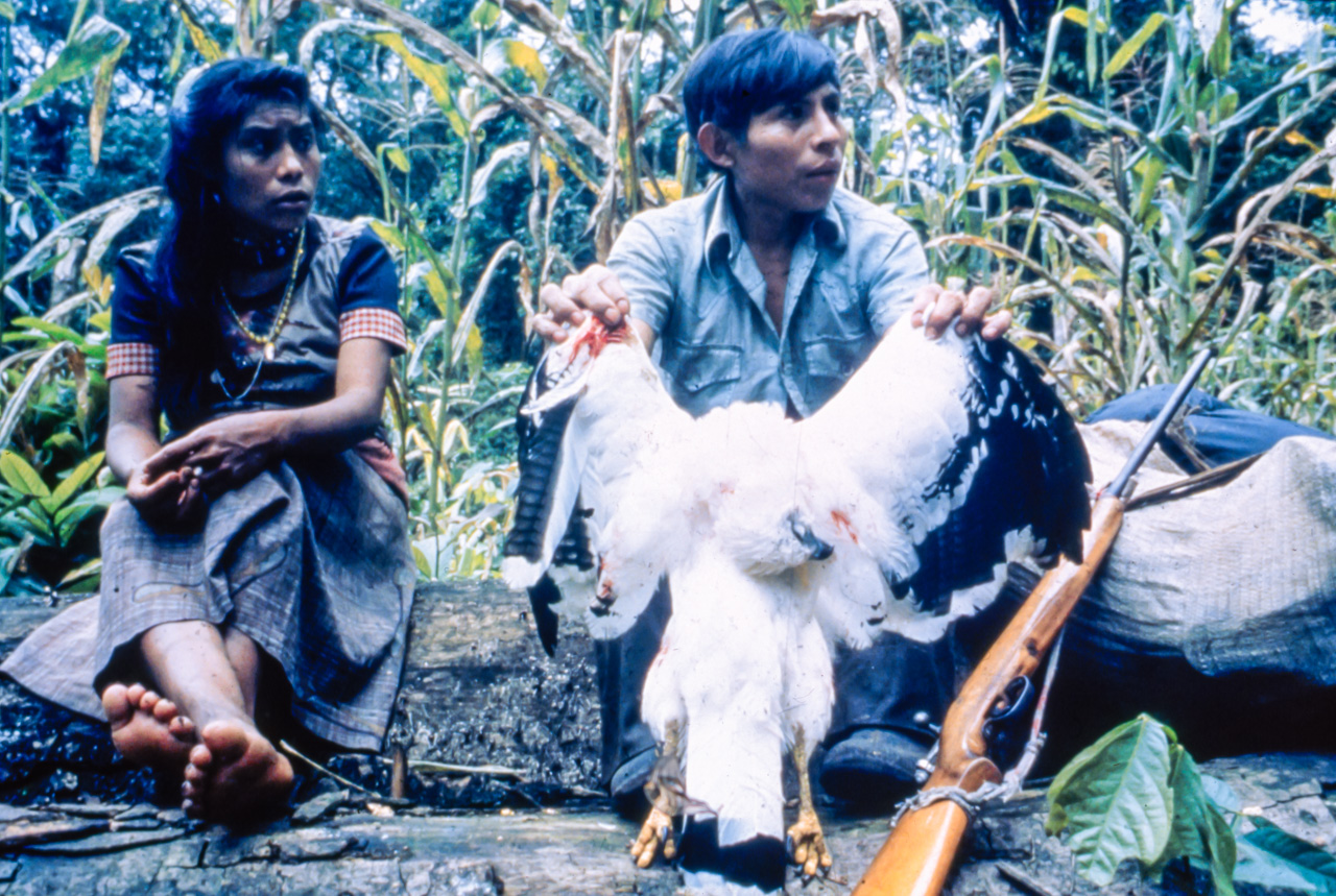
I was slogging along with my eyes glued to the trail, when I heard an overhead shriek. I looked up and stopped in my tracks and admired this huge, White Hawk (Leucopternis albicollis) as it glided past me. He flew out of view and moments later I heard a gunshot. My worst fears came true as I caught up to our guides who had already begun plucking feathers from this majestic creature.
The moment summed up our challenges in environmental education. How do you explain to a hungry indigenous person that in the long run that hawk he just killed could help feed his family many times over? How do you explain that there are gringos who would pay huge sums of money to someone like him to guide them into his backyard just for the chance to have a glimpse at majestic creature like that hawk?
To many like our guide, wild animals were there to be shot and eaten and forests where there to be cut down and cleared. The concept that anyone would take pleasure visiting the jungle – the basis of ecotourism – was totally foreign to him.
[NOTE: My original 35 mm slides remained in Costa Rica. Despite many efforts to locate them I can not. The photos used in this story are all created from duplicate slides which had lost a lot of the original quality.]